 geo.be Metadata Catalog
1 m
Type of resources
Available actions
Topics
INSPIRE themes
federalThemes
Keywords
Contact for the resource
Provided by
Years
Formats
Representation types
Update frequencies
status
Resolution
-
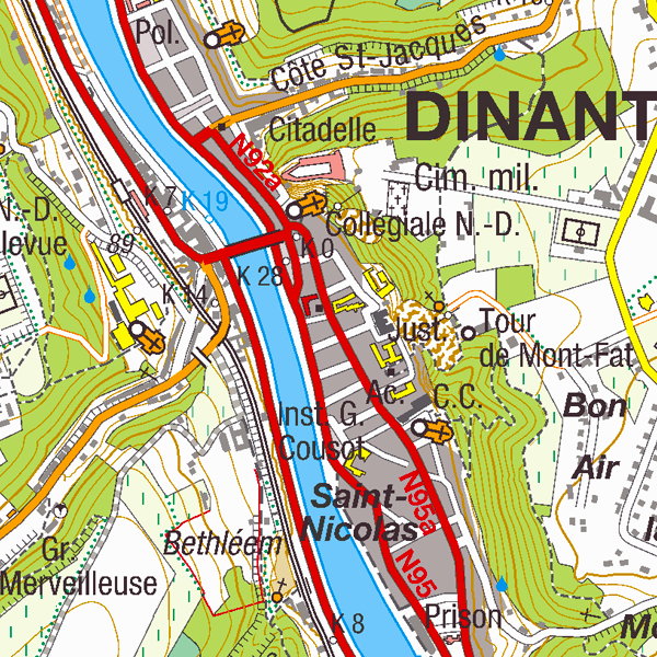
Top25Map is a digital version of the NGI’s topographic cartography on a scale of 1:25 000. These images result from the symbolisation of the objects and themes which are present in the topo-geographic inventory of the Belgian territory (ITGI), which is built and kept up-to-date by the NGI. Top25Map contains all usual themes of the NGI’s cartographic products (land use, transport, hydrography, buildings and constructions, relief,…), as well as the map lettering and the toponyms. The Top25Map cartography is appropriate to hiking.
-

The digital terrain model (DTM) is a homogeneous and regular point grid indicating the elevation of the ground level in order to make a model of its surface. The 1m DTM is obtained by interpolation in Lambert 2008 of the raw height data regrouping the source data, in Lambert 72 and at 1m resolution, of the Flemish and Walloon regions. The 5m DTM has as an additional source structure lines and adapted points, during the systematic and continuous updating by photogrammetric surveys. The 20m DTM, available for free download, is obtained by resampling the 1m DTM.